.png)

Date
|
ORIGIN
TIME
|
MAG
|
Depth km
|
location
|
Lat
|
Long
|
Map
|
PSN
|
AmaSeis
Event
|
Heli
corder
|
Sound
File
|
SCA
|
Notes
|
01/12/2013
|
07:06.06 UTC
|
3.1
|
103km
|
Puerto Rico Region
|
18.67
|
-65.97
|
MAP
|
PSN
|
AmaSeis
|
Heli
|
SOUND
|
SCA
|
|
01/12/2013
|
03:19.33 UTC
|
5.5
|
5km
|
Off the Coast of Northern California
|
41.68
|
-127.37
|
MAP
|
PSN
|
AmaSeis
|
Heli
|
SOUND
|
SCA
|
|
01/01/2013
|
01:24:14.0 UTC
|
6.5
|
10km
|
KEPULAUAN BARAT DAYA, INDONESIA
|
7.00 S
|
128.46 E
|
MAP
|
PSN
|
AmaSeis
|
Heli
|
SOUND
|
SCA
|
|
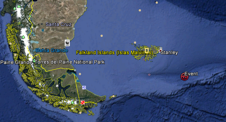
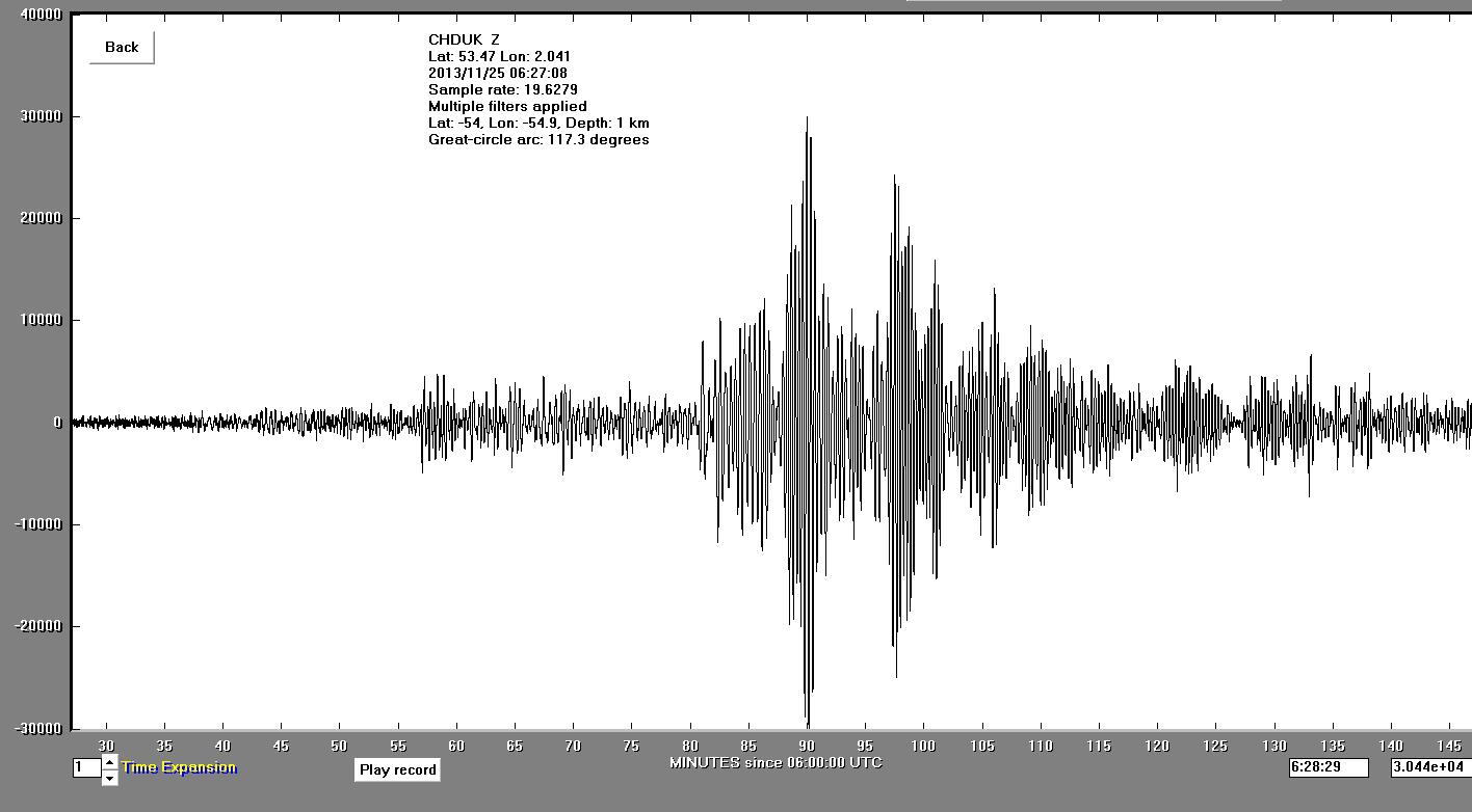
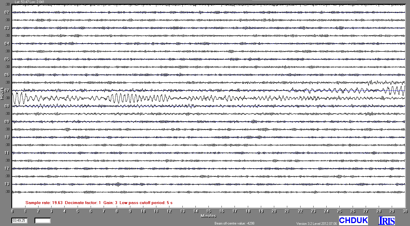
25/11/2013
|
06:27.08 UTC
|
6.6
|
1km
|
South Atlantic Ocean
|
54° 0'0.00"S
|
54°54'0.01"W
|
|||||||
23/11/2013
|
07:48.32 UTC
|
6.4
|
387.km
|
Fiji Region
|
-17.13
|
-176.34
|
MAP
|
PSN
|
AmaSeis
|
Heli
|
SOUND
|
SCA
|
|
17/11/2013
|
09:04.57 UTC
|
7.8
|
42 km
|
Scotia Sea
|
60°17'45.60"S
|
46°21'43.20"W
|
|||||||
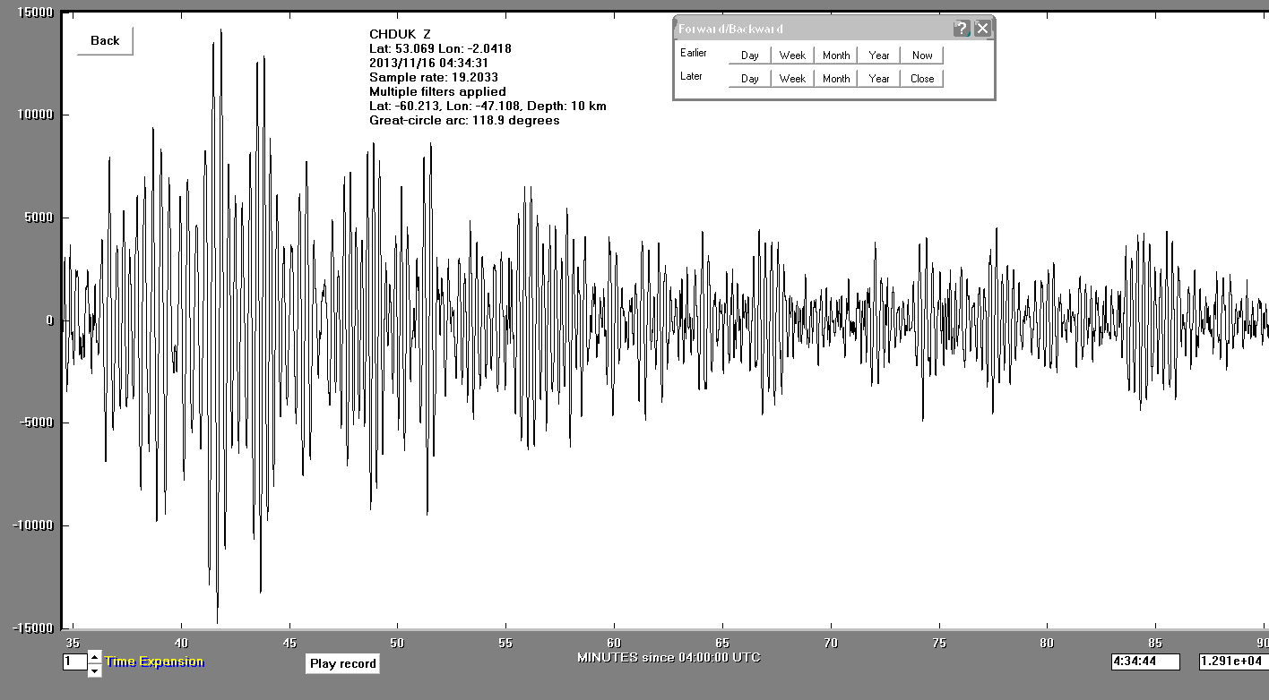
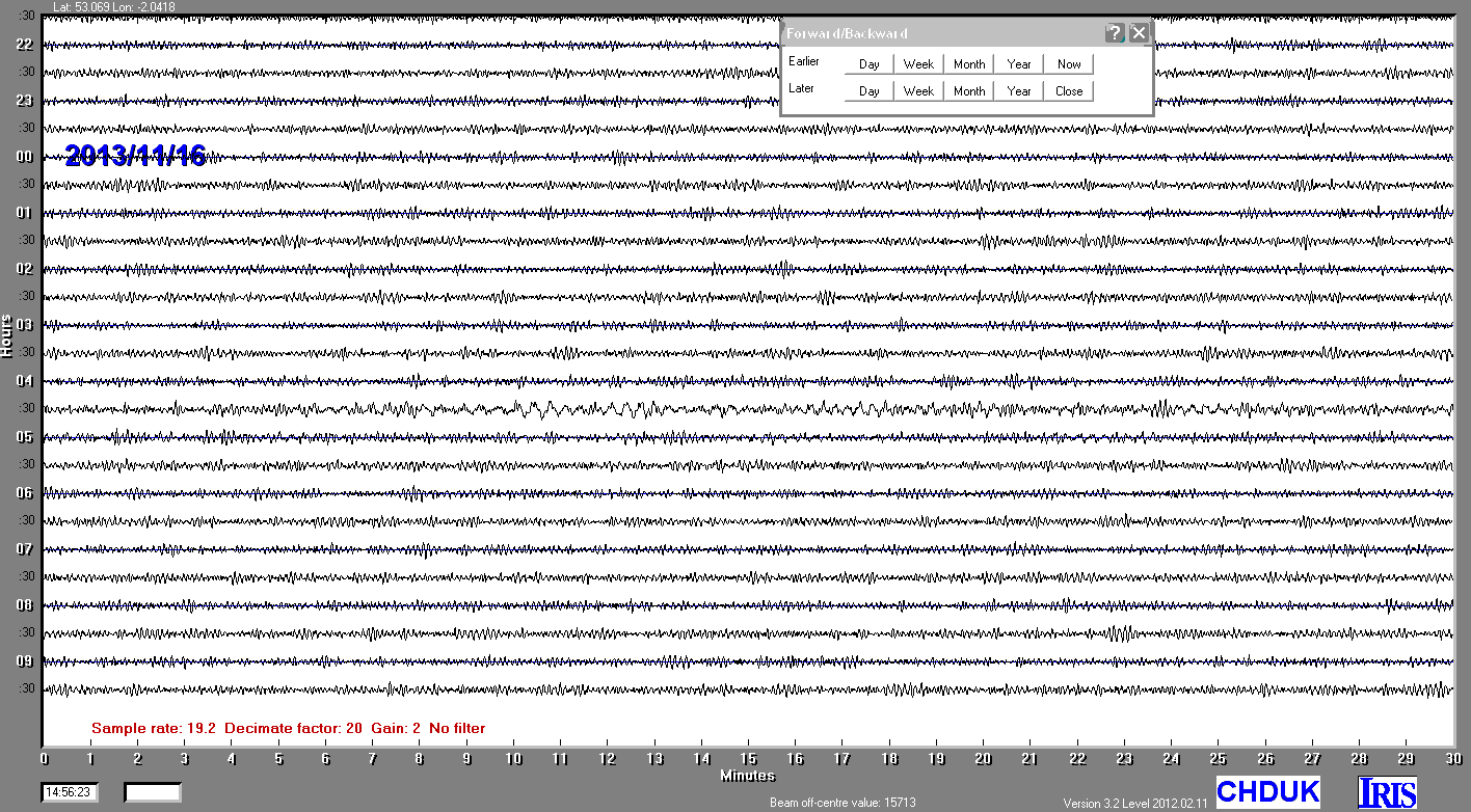
16/11/2013
|
03:34.31 UTC
|
7.4
|
23 km
|
Scotia Sea
|
60°12'46.80"S
|
47° 6'28.81"W
|
|||||||
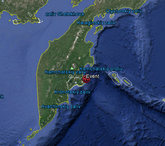
12/11/2013
|
07:03.52 UTC
|
6.6
|
57 km
|
Near the East Coast of the Kamchatka Peninsula, Russia
|
54°40'51.60"N
|
162°17'9.58"E
|
AmaSeis
|
||||||
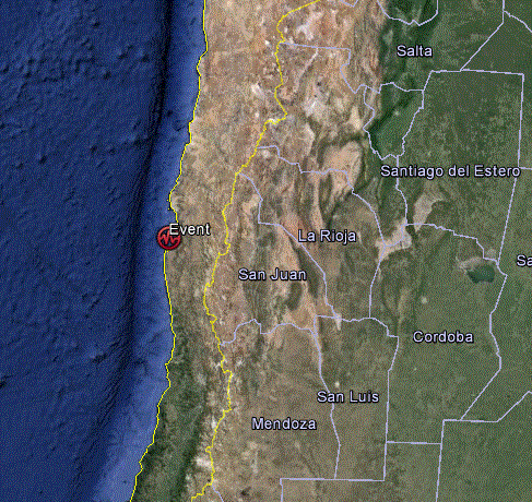
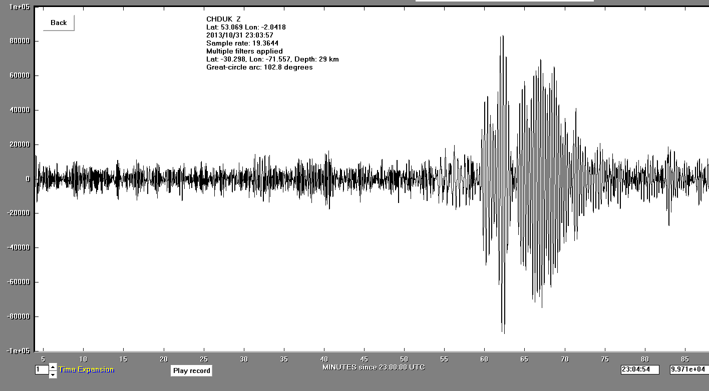
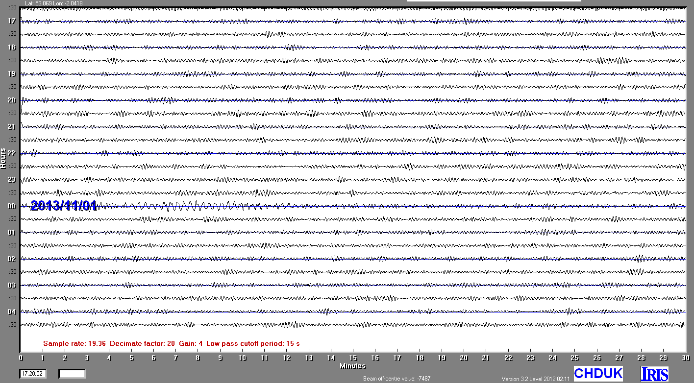
31/10/2013
|
23:03:59.0 UTC
|
6.6
|
29 km
|
COQUIMBO,CHILE
|
30°17'52.80"S
|
71°33'25.20"W
|
|||||||
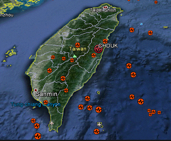
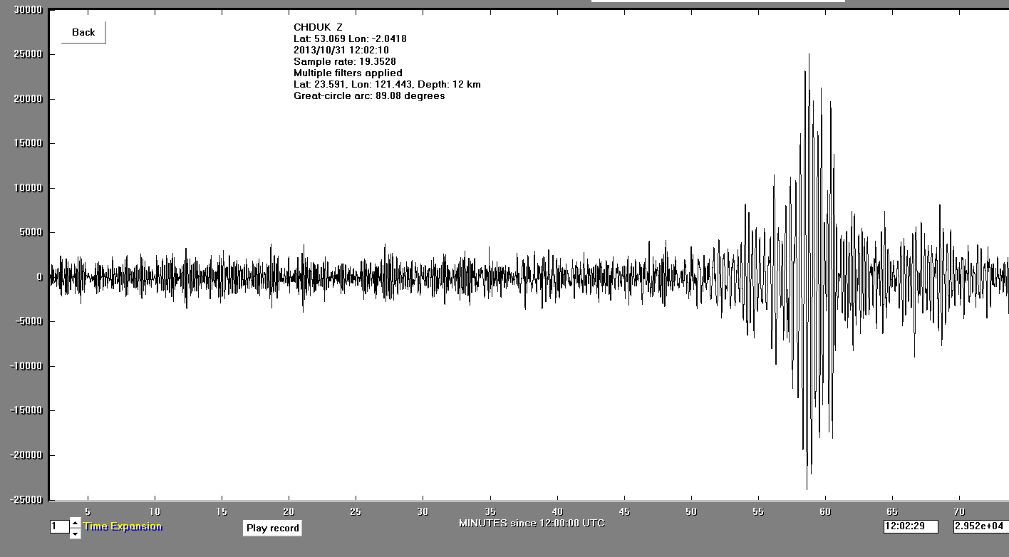
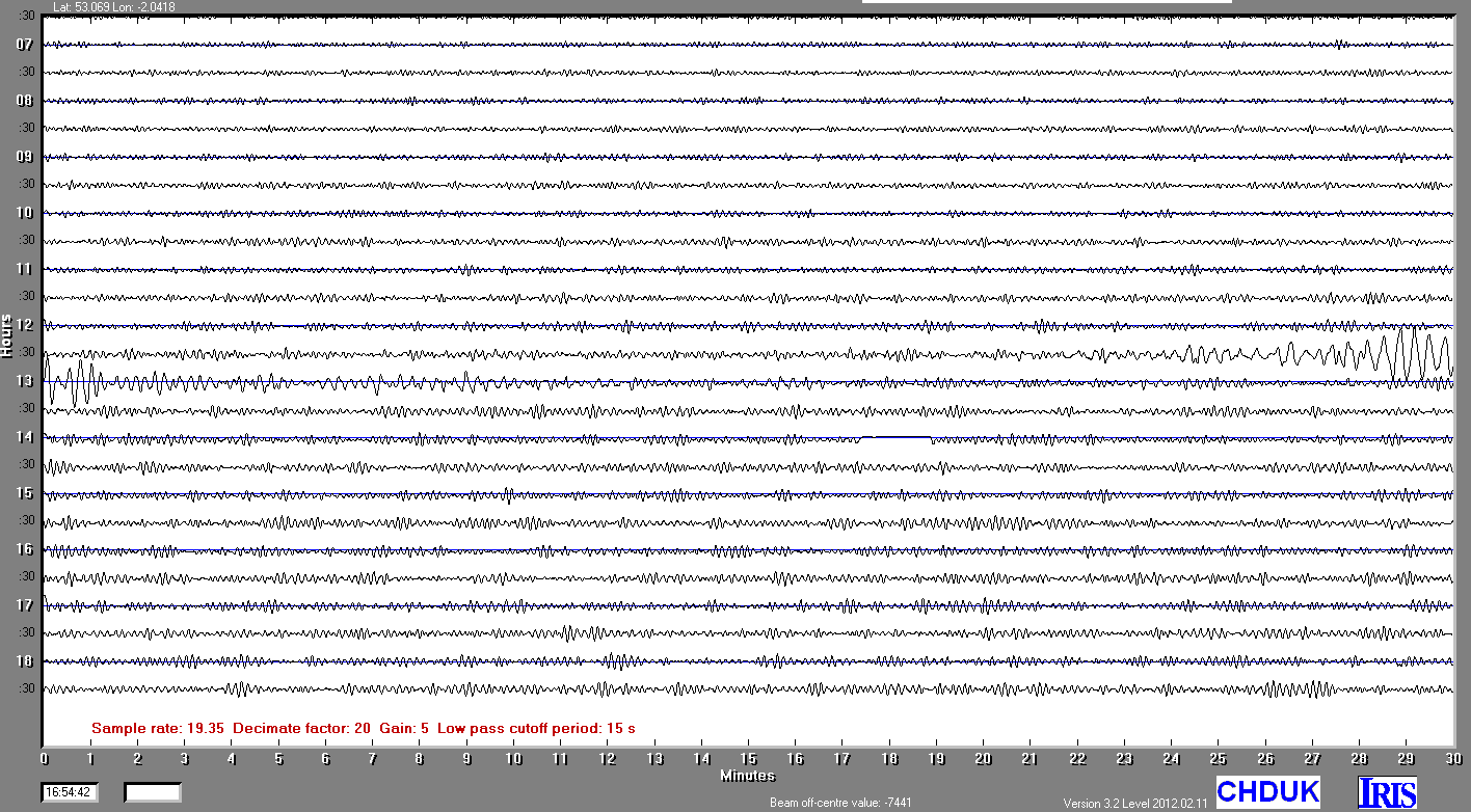
31/10/2013
|
12:02:09.0 UTC
|
6.3
|
12 km
|
TAIWAN
|
23°35'27.60"N
|
121°26'34.80"E
|
|||||||
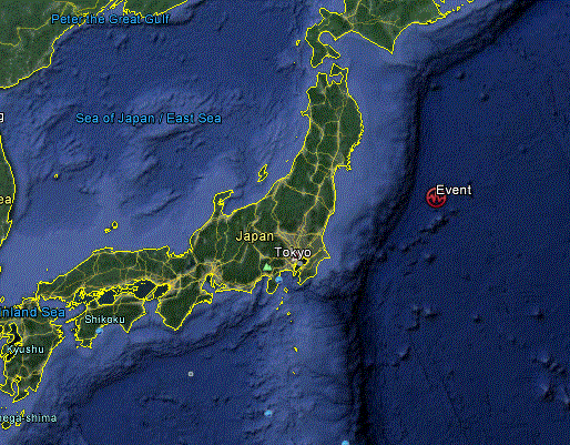
25/10/2013
|
17:10:16.0 UTC
|
7.5
|
10km
|
Off the East Coast of Honshu, Japan
|
37°10'11.99"N
|
144°39'53.97"E
|
|||||||
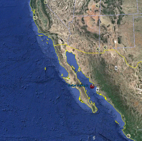
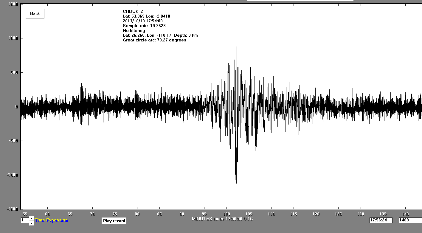
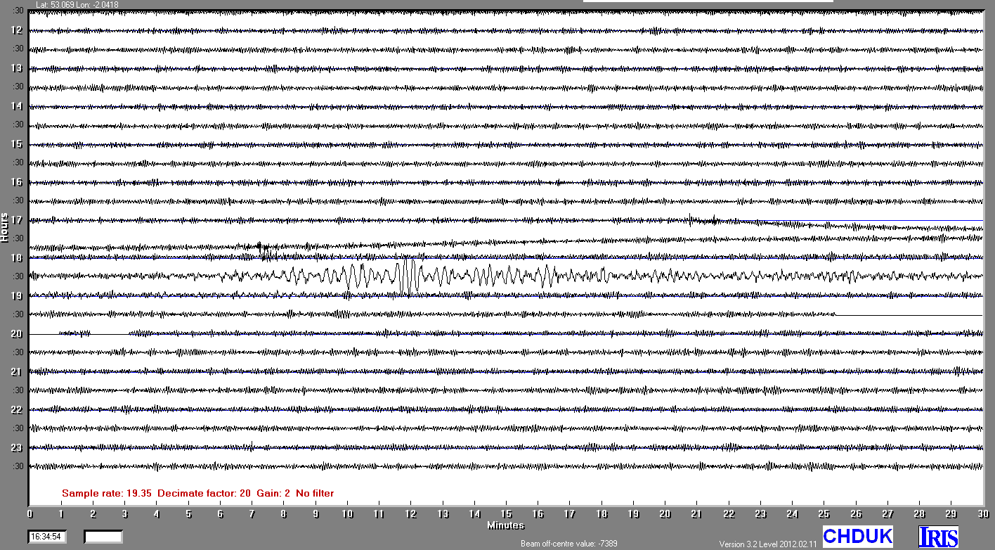
19/10/2013
|
17:54:56.0 UTC
|
6.5
|
8 km
|
GULF OF CALIFORNIA
|
26°16'4.80"N
|
110°10'11.99"W
|
|||||||